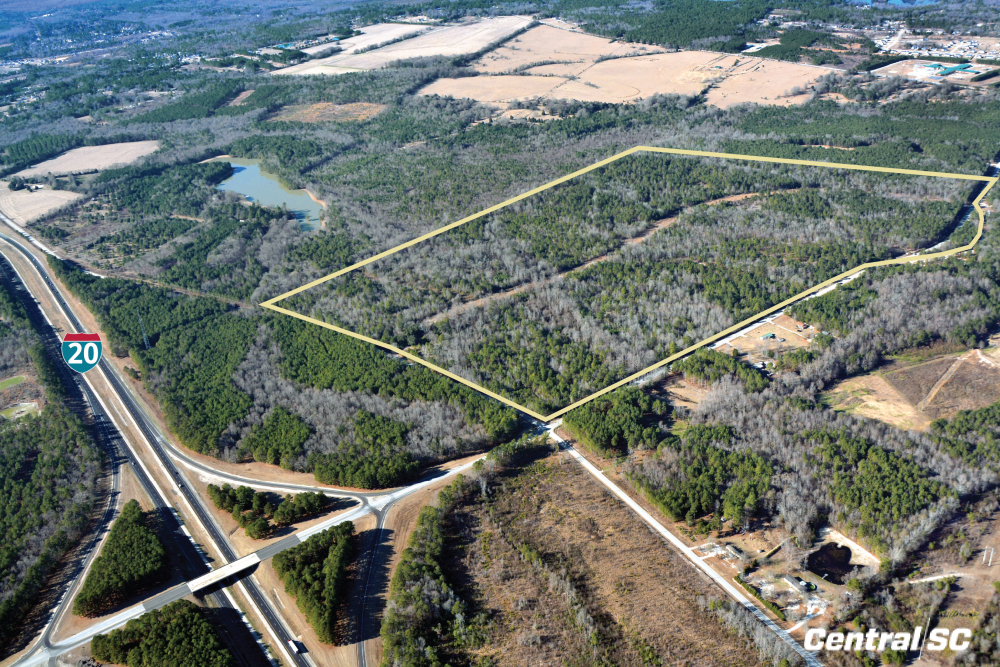
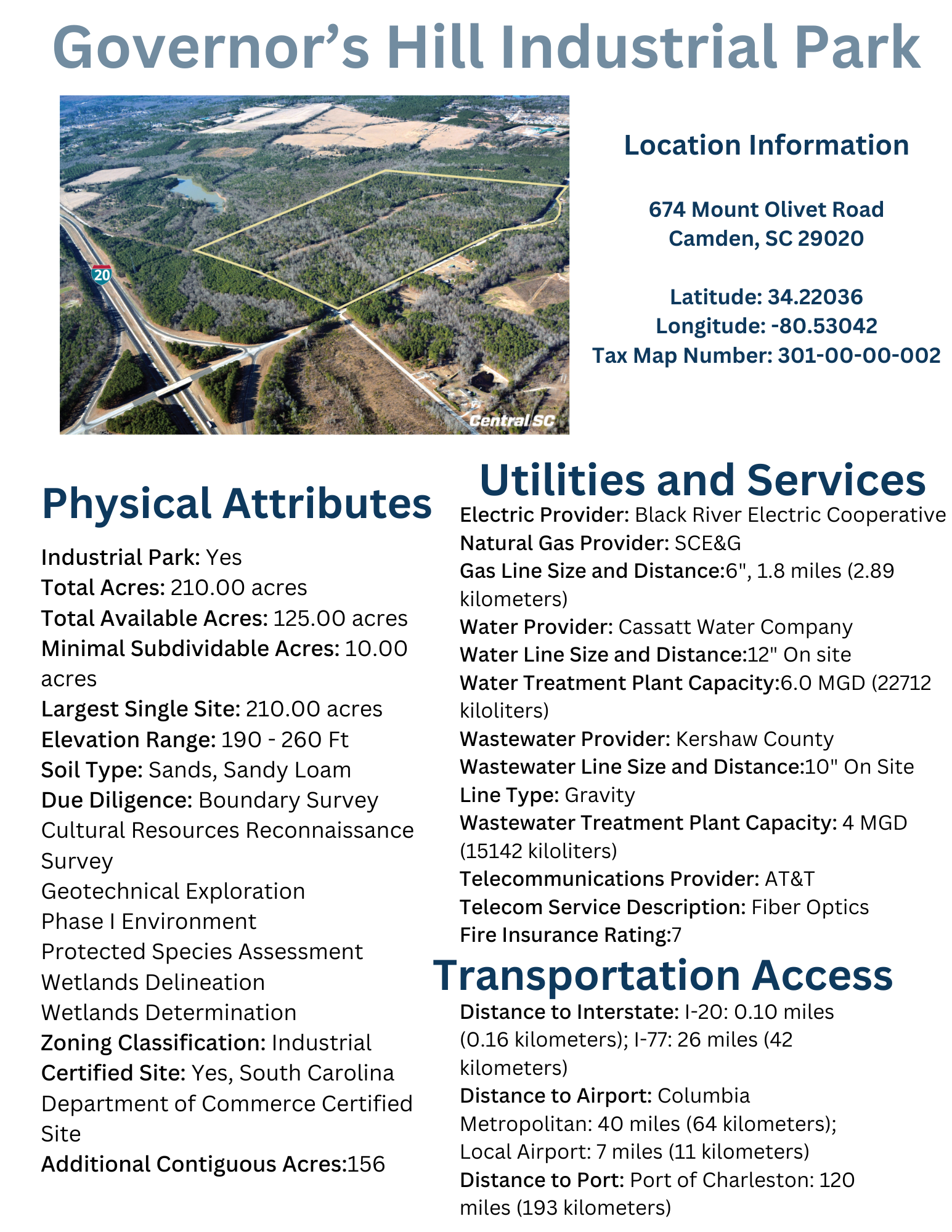
Governor’s Hill Industrial Park

Click an image above to view larger.

Location Information

Location Information

674 Mount Olivet Road
Camden, SC 29020

Latitude: 34.22036
Longitude: -80.53042
Tax Map Number: 301-00-00-002

Sale and Lease Information

Sale and Lease Information

Sale Price Per Acre: $15,000.00

Location Information

674 Mount Olivet Road
Camden, SC 29020

Latitude: 34.22036
Longitude: -80.53042
Tax Map Number: 301-00-00-002

Sale and Lease Information

Sale Price Per Acre: $15,000.00

Physical Characteristics

Industrial Park:Yes Total Acres:210.00 acres Total Available Acres:163.31 acres Minimal Subdividable Acres:10.00 acres Largest Single Site:210.00 acres Elevation Range:190 - 260 Ft Soil Type:Sands, Sandy Loam Due Diligence: Boundary Survey
Cultural Resources Reconnaissance Survey
Geotechnical Exploration
Phase I Environment
Protected Species Assessment
Wetlands Delineation
Wetlands Determination
Zoning Classification:Industrial Certified Site:YesSouth Carolina Department of Commerce Certified Site Additional Contiguous Acres: 48


Utilities and Service

Electric Provider: Black River Electric Cooperative Natural Gas Provider: SCE&G Gas Line Size and Distance: 6", 1.8 miles (2.89 kilometers) Water Provider: Cassatt Water Company Water Line Size and Distance: 12" On site Water Treatment Plant Capacity: 6.0 MGD (22712 kiloliters) Wastewater Provider: Kershaw County Wastewater Line Size and Distance: 10" On Site Line Type: Gravity Wastewater Treatment Plant Capacity: 4 MGD (15142 kiloliters) Telecommunications Provider: AT&T Telecom Service Description: Fiber Optics Fire Insurance Rating: 7


Transportation Access

Distance to Interstate: I-20: 0.10 miles (0.16 kilometers); I-77: 26 miles (42 kilometers) Distance to Airport: Columbia Metropolitan: 40 miles (64 kilometers); Local Airport: 7 miles (11 kilometers) Distance to Port: Port of Charleston: 120 miles (193 kilometers)

DOWNLOADS - MAPS & SITE REPORTS

BOUNDARY SURVEY
TOPOGRAPHIC SURVEY
PHASE I ENVIRONMENTAL SITE ASSESSMENT
NATIONAL WETLANDS INVENTORY MAP
JURISDICTIONAL WETLAND/WATERS DELINEATION
PROTECTED SPECIES ASSESSMENT
CULTURAL RESOURCES INDENTIFICATION SURVEY


{report-buttons}